Million Dollar Highway in Colorado is so spectacular and curvy in America. It is one of the most scenic routes across the country. I can honestly say that this 25-mile stretch winding through the towering San Juan Mountains is in a league of its own. It’s a drive where every single turn reveals plunging waterfalls, decaying ghost towns, majestic red peaks, and sheer drop-offs with absolutely zero guardrails to separate you from the abyss below. Million Dollar Highway is one of the best highways for USA road trips.
Whether you are an adrenaline junkie, a history buff obsessed with the Old West, or a nature lover looking for views that rival the Alaskan wilderness, the Million Dollar Highway has something for you. In this massive, comprehensive guide, we are going to drive from the “Switzerland of America” all the way to a historic silver mining town, stopping at the most breathtaking sights along the way. Grab your keys, check your brakes, and let’s dive into the ultimate Colorado road trip in USA!
What, Where, and How Long Is the Million Dollar Highway?
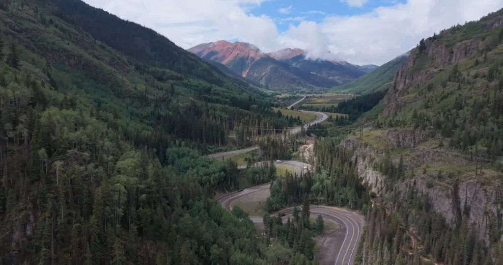
Let’s cover the basics. The Million Dollar Highway is a roughly 25-mile section of U.S. Route 550 located in southwestern Colorado. It connects the picturesque town of Ouray to the historic mining hub of Silverton.
To call this just a “highway” feels like an understatement. It is an engineering marvel carved directly into the side of the rugged San Juan Mountains. You’ll navigate tight switchbacks, ascend steep mountain passes, and skirt the edges of plunging gorges. It’s part of the larger San Juan Skyway Scenic Byway, but this specific 25-mile segment is the one that earns all the fame and the infamy.
The end points of this journey are:
- If you start from the north (Ouray), the end point is South (Silverton)
- If you start from the south (Silverton), the end point is north (Ouray)
This route is one of the most beautiful and dangerous roads in America. You go on top of the road in the midst of valleys. If you are not an expert in driving, just take the thought of traveling here out of your mind.
This journey takes around 40 to 45 minutes without stops. But be careful while you drive. Especially two-wheeler riders.
The Million Dollar Mystery: Where Does the Name Come From?
It is really a mystery about the name. Nobody even knows exactly how it came. There are some views on this:
- The Cost of Construction: Building a paved road through sheer granite cliffs and high-alpine environments in the late 19th and early 20th centuries was an incredibly arduous task. Some say the name stems from the fact that it cost exactly a million dollars a mile to build.
- The Million-Dollar Views: This is the most romantic theory, and once you drive it, you’ll probably agree. The sweeping vistas of the San Juan Mountains, the cascading waterfalls, and the alpine forests genuinely look like a million bucks.
- The Danger Factor: This is my personal favorite. The road is so treacherous in certain sections that early travelers would allegedly look at the sheer cliffs and say, “You couldn’t pay me a million dollars to drive that highway in the snow!”
I’ll let you decide which theory fits best by the end of this post! And read our articles if you want to travel around the USA alone.
Million Dollar Highway Route: Ouray to Silverton
Ouray, Colorado — The Best Place to Start
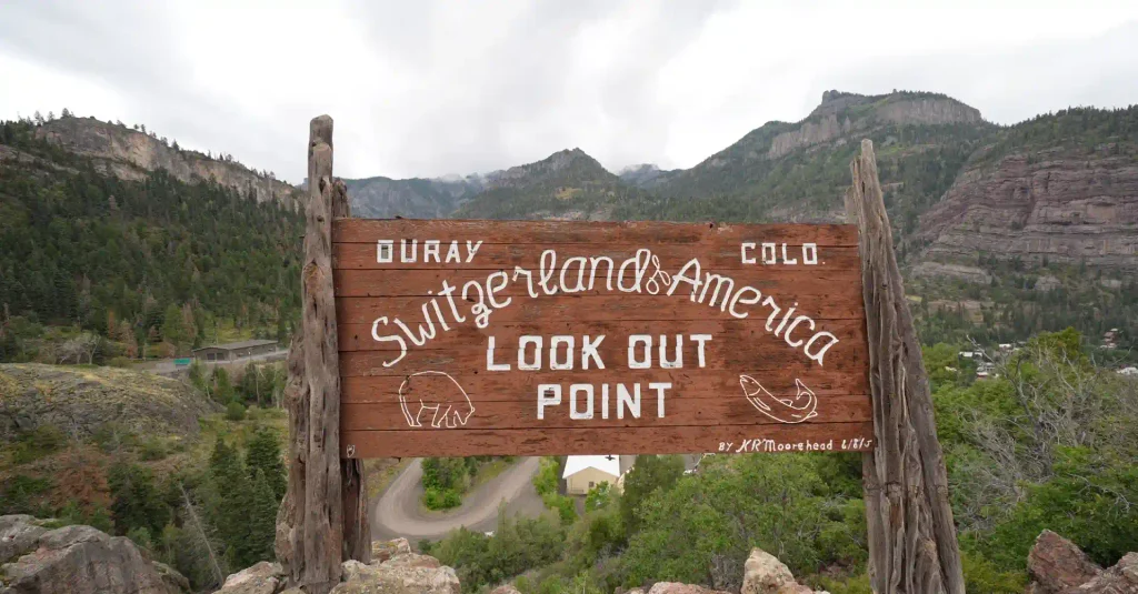
Our road trip begins in Ouray, Colorado, a town so stunningly beautiful that it has officially been dubbed the “Switzerland of America.” And honestly? That description is spot on.
Nestled in a tight, box canyon surrounded by jagged, snow-capped peaks on all sides, Ouray feels like a secret alpine village completely detached from the rest of the world. The architecture drips with Victorian charm, and the crisp mountain air immediately sets the tone for an epic adventure. We spent the night here, waking up early to explore the town before officially merging onto the highway.
If you are planning this trip, I highly recommend spending at least a full day in Ouray. From soaking in the local hot springs to strolling down Main Street, it’s the perfect launchpad for the adrenaline-fueled drive ahead.
Stop 1: Box Canyon Falls
Before you even get your tires warm on the Million Dollar Highway, there is a mandatory pit stop just on the edge of Ouray: Box Canyon Falls.
This is a fantastic, short hike that is easily accessible for families and casual walkers. The walk from the parking lot to the falls is only about 500 feet. There is a small entrance fee to access the park—when I visited, it was $8 for adults and $7 for kids—but it is worth every single penny.
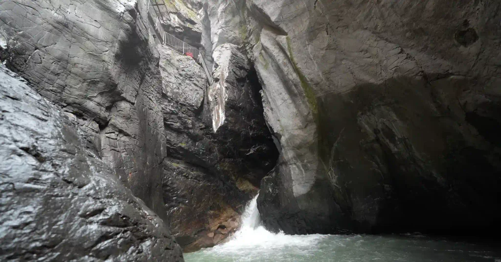
The hike is built around an incredible network of elevated steel platforms and walkways that allow you to get right up close and personal with the roaring water. You have a few options here. You can take the stairs down to the base to view the falls from below, or you can hike out to see it plummet from above. I suggest doing both!
The Power of the Falls
Even visiting at the end of the summer, the waterfall was booming. With an official listed height of 285 feet, the water violently plummets into the narrow gorge below. But almost as impressive as the waterfall itself is the canyon that looms around it. Standing at the bottom, looking up at the sheer rock walls framing the rushing water, you feel incredibly small.
We spent about 30 minutes here just soaking in the views. It vividly reminded me of the elevated walkways and epic waterfalls you might see in places like Banff, Canada. It is the perfect, awe-inspiring start to our journey.
Stop 2: Bear Creek Falls and Sketchy Section
Leaving Ouray behind, we officially started the Million Dollar Highway. Almost immediately, you realize why this road is world-renowned.
About three miles into the drive, you’ll find a small turnout on the right side of the road. This is Bear Creek Falls. There is a dedicated viewing platform that juts out into the open air, allowing you to look straight down. And when I say straight down, I mean straight down. The waterfall cascades roughly 200 feet into the cavernous canyon below, passing directly underneath the highway you were just driving on. If you have a fear of heights, this platform will definitely get your heart rate up!
Stop 3: The Guardrail-Free Section
Right after you leave Bear Creek Falls, you enter what is widely considered the most dangerous stretch of road in America. For the next three to four miles, the highway narrows significantly. And the most glaring feature? There are no guardrails.
Why, you ask? Because in the winter, the snowfall in the San Juan Mountains is so heavy that guardrails would trap the snow on the road, making it impossible for snowplows to push it off the cliffs. So, for the sake of winter maintenance, summer drivers are left with a white-knuckle experience.
In some sections, you have only a couple of feet of pavement between your tires and a sheer drop-off into the gorge. As the driver, your eyes stay glued to the road. As a passenger, you get to look down into the abyss.
Traveler’s Note: I had read horror stories about this section, and while it is definitely sketchy, it wasn’t quite as terrifying in the summer as the internet makes it out to be. However, I would be absolutely terrified to drive this in the winter. Always check road conditions before you go. Even in the summer, this highway is prone to sudden rockslides and mudslides that can close the road without warning.
For images, Kindly follow us on Pinterest
Stop 4: Red Mountain Creek and the Red Mountains
Once you survive the guardrail-free gauntlet, the road begins to shift. You hit a series of five steep curves that help your vehicle gain vital uphill momentum. As we came out of this curvy section, we were greeted by my absolute favorite view of the entire drive.
We found a random pull-off on the side of the road, stepped out of the car, and were completely blown away. The landscape changes dramatically here. Towering in the distance are peaks boasting deep hues of crimson and rust—aptly named the Red Mountains.
But what really catches your eye is the water running through the valley. Red Mountain Creek is a bright, vivid yellow. The stark contrast of the yellow river weaving its way beneath the imposing red mountains is a sight you truly have to see to believe. The unique coloring is due to the heavy mineralization in the rocks and the area’s extensive mining history.
Standing there, breathing in the crisp mountain air and looking at the untamed wilderness, I honestly felt like I had been teleported to the rugged expanses of Alaska.
Stop 5: Treasury Tunnel & Red Mountain Overlook: The Summit of the Drive
Returning to the Million Dollar Highway, the historical landmarks come fast and frequent. You will constantly see old mining structures clinging precariously to the mountainsides.
As we drove towards our ultimate destination of Silverton, the road began to aggressively gain elevation, throwing a bunch of dramatic switchbacks and bends our way. Right around the halfway mark of the drive (about 12 miles in), we pulled over at the Red Mountain Overlook.
From here, you are treated to sweeping views back into the canyon. There are informative plaques detailing the history of the Treasury Tunnel, which incredibly contains nearly 100 miles of underground mining tunnels branching out beneath the mountains. You can also look across the valley to see the iconic Yankee Girl Mine standing proudly on the hillside. (There is a 4×4 trail to reach it, but recent rains made it too muddy for our car).
Red Mountain Pass
Just two miles after the overlook, you hit the literal high point of the trip: Red Mountain Pass.
Sitting at a staggering elevation of 11,018 feet, crossing this pass feels like a true accomplishment. A sign proudly states that gold ore wagons first crossed this exact spot in 1878. Think about that for a second. We were crossing in a modern vehicle with a heater and paved roads, but over 140 years ago, miners were hauling heavy wagons of rock over this treacherous, freezing pass while dodging outlaws trying to steal their gold. It really puts the “Wild West” into perspective!
Stop 6. Exploring the Ironton Ghost Town
Only about 8.5 miles from where we started in Ouray, we made our next major stop. We turned off the highway onto a small dirt road. We drove for about two minutes before the rocks got a bit too big for our vehicle, so we parked and walked the final tenth of a mile into the woods.
Suddenly, a decaying piece of the Old West emerged through the trees. This is the Ironton Townsite, a genuine Colorado ghost town.
Founded in 1883, Ironton was a booming mining hub. In its very first year, over 100 buildings were constructed in this high-alpine basin. At its heyday, it boasted over a thousand residents, its own newspaper, a post office, and served as a vital stagecoach and freight junction for the surrounding silver and gold mines. By 1889, the railroad even reached the town.
Walking through Ironton today is a beautifully eerie experience. Because it sits at almost 10,000 feet of elevation, the cold, dry air has preserved the wooden structures surprisingly well. Everywhere you look, buildings are in varying states of decay. You can actually step inside some of them—though I wouldn’t trust the wooden staircases!
The town actively supported mining until the 1930s. The most fascinating story of Ironton belongs to its final resident, a man named Milton Larson. Long after everyone else abandoned the town, Milton stayed, living entirely alone amongst the decaying buildings all the way until the 1960s. When he passed away, the final chapter of Ironton was officially closed. It’s incredibly rare to explore ruins like this all by yourself without crowds of tourists. It was a profound highlight of the highway.
Stop 7: Descending into Silverton: The Wild West Lives On
Once you crest Red Mountain Pass, the descent into Silverton begins. You lose about 1,500 feet of elevation over the next several miles.
A quick warning: If you drive the Million Dollar Highway in reverse (from Silverton to Ouray), this descent from the pass is where you will experience the harrowing, guardrail-free outside lane. Because we were driving south, we were hugging the mountain wall, which felt much safer.
There are a few great pull-outs on the way down where you can spot distant waterfalls crashing down the alpine slopes. The last six miles into Silverton are a bit more relaxed. The views are still gorgeous, but after the sensory overload of the first 20 miles, your brain finally gets a chance to relax.
Welcome to Silverton (Elevation: 9,318 ft)
We finally rolled into Silverton, Colorado, officially completing the Million Dollar Highway!
Silverton is a town frozen in time. It was founded in 1871 after a highly profitable silver vein was discovered in the area. When the railway arrived in 1882, the town exploded into a mining boomtown, a golden era that lasted until the 1910s. Today, it retains all of its rugged, dirt-road, Victorian-era charm.
Fun fact for motorcycle enthusiasts: Silverton is home to the world’s highest Harley-Davidson store!
After walking around the historic shops, we built up an appetite and stopped at Daredelli and Bar for lunch. If you ever find yourself here, do yourself a favor and get the French Dip sandwich. We also tried a highly unique sandwich made with fresh peaches. Both were absolutely incredible, hearty meals to refuel us after a long morning of driving.
Stop 8 . Going Underground: The Old Hundred Gold Mine Tour
You can’t drive the Million Dollar Highway, explore ghost towns, and gaze at old mining structures without actually seeing what it was like inside a mine. So, I left my travel partner at a local coffee shop and drove 15 minutes outside of Silverton to the Old Hundred Gold Mine.
Getting there is an adventure in itself. You have to drive about 4 miles down a remote dirt road deep into a massive canyon. Way up on the canyon walls, you can see the old tram houses perched precariously on the cliffs. It makes the Jeeps down below look like tiny matchbox toys.
Riding the Vintage Mine Train
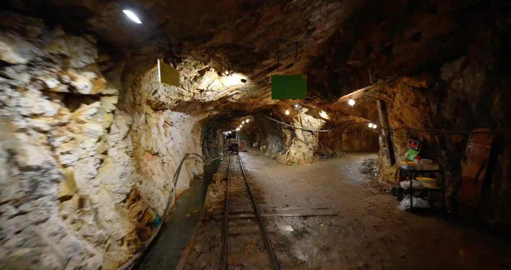
The Old Hundred Gold Mine tour operates out of a claim that was originally staked by three German brothers way back in 1872. They tried to work the claim themselves for decades before selling it to a company that drove a massive tunnel into the mountain at an elevation of 12,750 feet. The mine never turned a massive profit, changing hands several times before finally closing in 1970. Twenty years later, it reopened as the tourist attraction it is today.
After getting geared up with a hardhat and slicker, the tour begins with a bang. You board a vintage, electric-powered mine train that takes you a full 1,600 feet straight into the heart of the mountain. Having done plenty of cave and mine tours across the country, I can safely say that riding an authentic mine train deep into the pitch-black is a rare and thrilling experience.
A Masterclass in Mining History
The tour lasts about 45 minutes, but what makes it truly exceptional is the staff. Our guide, Trent, had actively worked as a miner in the local area for 10 years, and both his father and grandfather were miners before him.
This wasn’t a scripted, cheesy tourist trap. Trent had an encyclopedic knowledge of the industry. He walked us through the evolution of mining equipment, and the best part? Every time he showed us a piece of vintage machinery, he actually turned it on to demonstrate how it worked. The noise in the confined rock tunnel was deafening but incredibly cool. Being able to ask questions to someone who actually lived this dangerous lifestyle made the $8 admission price an absolute steal. If you make it to Silverton, you must do this tour.
(Note: They operate tours on the hour from 9:00 AM to 2:00 PM in the late summer. They do not operate in the winter, and they don’t take advance reservations—you just show up and get on the next train. Always check their current schedule before driving out!)
8. A Grand Finale: Christ of the Mines Shrine
After emerging 1,600 feet out of the earth, I drove back to Silverton, picked up my travel partner, and we headed to our final stop of the day: the Christ of the Mines Shrine.
Situated on a hill overlooking the entire town of Silverton, the shrine was erected by the local citizens in 1959. Its purpose was simple: to ask for God’s blessing and protection over the mining industry of the San Juan Mountains. Though the heavy mining days have long since passed, the shrine still stands proudly as a testament to the town’s heritage. It is credited by locals for several miracles over the years.
Standing beside the shrine, looking out over the historic rooftops of Silverton framed by the jaw-dropping peaks of the San Juans, was the perfect way to cap off our journey.
Conclusion: A Road Trip Like No Other
If you haven’t realized it by now, the Million Dollar Highway is not just a road; it is a destination. It is a 25-mile museum of American history, engineering, and raw, unfiltered natural beauty.
From the thundering waters of Box Canyon and Bear Creek Falls to the eerie quiet of the Ironton ghost town, and from the white-knuckle, guardrail-less cliffs to the depths of the Old Hundred Gold Mine, this drive delivers at every single turn. It truly felt like a slice of wild Alaska hidden right in the heart of Colorado.
If you respect the road, drive cautiously, and take the time to pull over and absorb the history, the Million Dollar Highway will undoubtedly be one of the best drives of your entire life.
The Million Dollar Highway FAQ: Everything You Need to Know
To make sure your trip goes off without a hitch, I’ve compiled answers to some of the most commonly asked questions about driving the Million Dollar Highway.
1. How long does it take to drive the Million Dollar Highway? The highway itself is only 25 miles long. If you drove it straight through without stopping, it would take about 45 minutes to an hour due to the slow speed limits and sharp curves. However, to truly experience it, you should plan for at least 3 to 4 hours to allow time for pull-offs, photography, and exploring ghost towns like Ironton.
2. Is the Million Dollar Highway really that dangerous? It definitely demands your full attention. The road lacks guardrails in some of the steepest sections (specifically a 3-4 mile stretch south of Ouray), features sharp hairpin turns, and has sheer drop-offs. In the summer, confident drivers in good weather will find it totally manageable. In the winter, snow, ice, and avalanches make it incredibly hazardous, and it should only be attempted by highly experienced winter drivers with the proper vehicles.
3. Which direction is the best way to drive the highway? Driving South (from Ouray to Silverton) puts you on the inside lane, hugging the mountain wall for the majority of the steep drop-offs. Driving North (from Silverton to Ouray) puts you on the outside lane, directly next to the cliff edge. If you are afraid of heights, driving South from Ouray is highly recommended!
4. Can RVs drive the Million Dollar Highway? Yes, RVs can and do drive the highway. However, the lanes are narrow, there are no shoulders, and the switchbacks are extremely tight. If you are not comfortable maneuvering a large rig on steep mountain passes without guardrails, you may want to find an alternate route.
5. When is the best time of year to drive the Million Dollar Highway? Late summer and early fall are arguably the best times. In the summer, the roads are clear, and waterfalls like Box Canyon are flowing nicely. In the fall (late September), the aspen trees turn a brilliant gold, providing some of the most spectacular fall foliage in the United States.