The Blue Ridge Parkway is one of the very special road trips in USA. The Parkway is almost 470 miles long and passes through two states. They are Virginia and North Carolina. The Parkway connects the area around Shenandoah National Park with Great Smoky Mountains National Park. You don’t drive it simply to get from Virginia to North Carolina. You drive it to watch the mountains unfold around every bend, pull over at an overlook when the view catches you. This is 469 miles of winding two-lane road that covers beautiful and stunning destinations like the Appalachian Mountains, Misty blue ridges, golden autumn forests, and wildflower-covered meadows.
If you’re planning a weekend getaway, a week-long scenic drive, a fall foliage trip, or your first long road trip through the Appalachian Mountains, this guide will help you understand the route, choose the best stops, plan your itinerary, find places to stay, and avoid the most common mistakes.
The Blue Ridge Parkway isn’t a conventional highway designed to get you somewhere quickly. It was built as a scenic route through the Southern Appalachian landscape, and that difference changes how you should plan your trip. One section may give you a broad mountain panorama, while another takes you through dense forest before suddenly opening onto a valley view.
That’s why I wouldn’t recommend treating the Parkway like a route you simply check off your list. The best Blue Ridge Parkway scenic drive is one where you leave room for spontaneous stops.
Before going deeper, let us see everything on the surface:
| Blue Ridge Parkway Details | A quick look on Blue Ridge Parkway |
|---|---|
| Start Point | Rockfish Gap, Virginia — Milepost 0 |
| End Point | Near Cherokee, North Carolina — Milepost 469 |
| Total Length | 469 miles |
| States Covered | Virginia & North Carolina |
| Route Number | Blue Ridge Parkway to National Parkway (not a standard U.S. numbered highway) |
| Maximum Speed Limit | 45 mph, with lower limits in some sections |
Where Does the Blue Ridge Parkway Start and End?
One of the most common questions from first-time visitors is: where does the Blue Ridge Parkway start and end?
The Blue Ridge Parkway starts at Rockfish Gap near Waynesboro, Virginia, at Milepost 0. It goes south through Virginia and into North Carolina, ending near Great Smoky Mountains National Park at Cherokee, North Carolina, at Milepost 469.
That gives you an excellent way to understand the entire route from start to finish: Virginia Milepost 0 to North Carolina Milepost 469.
However, you don’t have to drive all 469 miles. In fact, many travelers shouldn’t. A shorter section can make a much better trip if you only have a few days.
For a first visit, the sections around Roanoke, Boone, Blowing Rock, Asheville and the southern mountains offer plenty to explore without requiring you to drive the entire Parkway.
Blue Ridge Parkway Route Number: What Should You Put in Your GPS?
This can be confusing if you’re accustomed to American highways having a clear route number.
The Blue Ridge Parkway is generally identified by its name rather than functioning like an ordinary numbered U.S. or state highway. The most useful navigation system on the Parkway is actually the milepost system. You can actually set your location through Google Maps or Apple Maps.
Every mile along the Parkway is marked, beginning at Milepost 0 in Virginia and increasing as you travel south. The National Park Service specifically recommends using mileposts because standard GPS systems don’t always handle Parkway addresses well. So instead of searching for a vague destination such as “Blue Ridge Parkway,” it’s much better to know the milepost, nearby town, or specific attraction you’re trying to reach.
Blue Ridge Parkway Map: From Start to Finish
A Blue Ridge Parkway map is one of the most useful things you can have before starting the drive.
The official National Park Service map shows the Parkway by milepost and identifies major attractions, roads, visitor centers, campgrounds and access points. NPS also provides downloadable official maps and recommends checking the road-status page because closures and construction can change your route
The Virginia section takes you through places such as Humpback Rocks, Peaks of Otter, Roanoke, Rocky Knob and the Blue Ridge Music Center. North Carolina then brings you toward Boone, Blowing Rock, Linville, Mount Mitchell, Asheville and the southern mountains before the Parkway reaches Cherokee.
If you’re searching for a Blue Ridge Parkway map Virginia, concentrate on the northern portion from Rockfish Gap through the Virginia mountains. The Virginia section has its own collection of scenic overlooks, trails and historic attractions, making it worth exploring independently if you don’t have enough time for the complete drive. Anyway check the map below for clear understanding.
The above map is taken from the Library of Congress.
Blue Ridge Parkway Road Trip Itinerary
The right itinerary depends on how much time you have. But one or two days is not at all enough to travel all of this. So consider a 3-day-or-more plan.
3-Day Blue Ridge Parkway Road Trip
For a long weekend, don’t attempt to drive the entire Parkway. Choose a section. One of the easiest approaches is to focus on the North Carolina mountains, beginning around Boone or Blowing Rock and continuing toward Asheville. This gives you access to mountain scenery, waterfalls, hiking trails, overlooks, and some of the Parkway’s most recognizable landscapes.
Another option is to explore a section around Roanoke and the Virginia Highlands.
The key is to spend more time outside the car. Three days should feel like a mountain escape, not a race. If you always stay in the car, you get tired of travelling. Just go and get chilled on foot.
5-Day Blue Ridge Parkway Road Trip
Five days gives you considerably more flexibility. You could begin around Roanoke, travel south through Virginia, continue into North Carolina and finish around Asheville. Alternatively, start in Asheville and explore north toward Boone and the Virginia border. You can get extraordinary scenic views on the Blue Ridge Parkway if you plan 5 days!
7-Day Blue Ridge Parkway Road Trip
A week is a much better timeframe if your goal is to experience a substantial portion of the route.
You could divide the trip into two or three-night stays rather than changing hotels every night. But you should have a good budget. This gives you the freedom to explore surrounding towns and no rush to cover all locations!
If you want to drive the entire route from Virginia to Cherokee, remember that the Parkway is designed for slow travel. Seven days can work, but it will still require considerable driving.
18 Best Stops for Blue Ridge Parkway Viewpoints
Blue Ridge Parkway Viewpoints & Hikes
If you want to stretch your legs and catch some unforgettable views, these spots deliver.
- Humpback Rocks: This is a tough, steep hike, but the payoff is unreal. Scramble out onto the rocky outcrop for a perfect sunset view. If you stay out late, keep an eye out for fireflies on the hike back to the car!
- Craggy Pinnacle: A gorgeous, easy 1.25-mile round-trip hike through rhododendron tunnels leads you to an incredible 360-degree viewpoint above the trees.
- Mount Mitchell: At 6,684 feet, this is the tallest mountain east of the Mississippi. You can drive almost all the way up, leaving just a short third-of-a-mile walk to the summit marker.
- Peaks of Otter: Nestled around Abbott Lake with sharp and flat-top mountains in the background, this area has been a tourist favorite since the 1830s. Catch a sunset at the lodge or take a challenging hike to the top.
- Chimney Rock: About 45 minutes off the parkway, this geological marvel is well worth the detour. You can hike (or take an elevator) to a bridge that walks you right out onto the rock for sweeping 10-mile gorge views.
Unforgettable Waterfalls
You can’t drive the parkway without pulling over to appreciate the water features.
- Crabtree Falls: Honestly, this one is hard to beat. The 2.5-mile trail takes you down to a stunning 60-foot cascade. There’s a perfect little bench on a bridge right in front of it to just soak it all in.
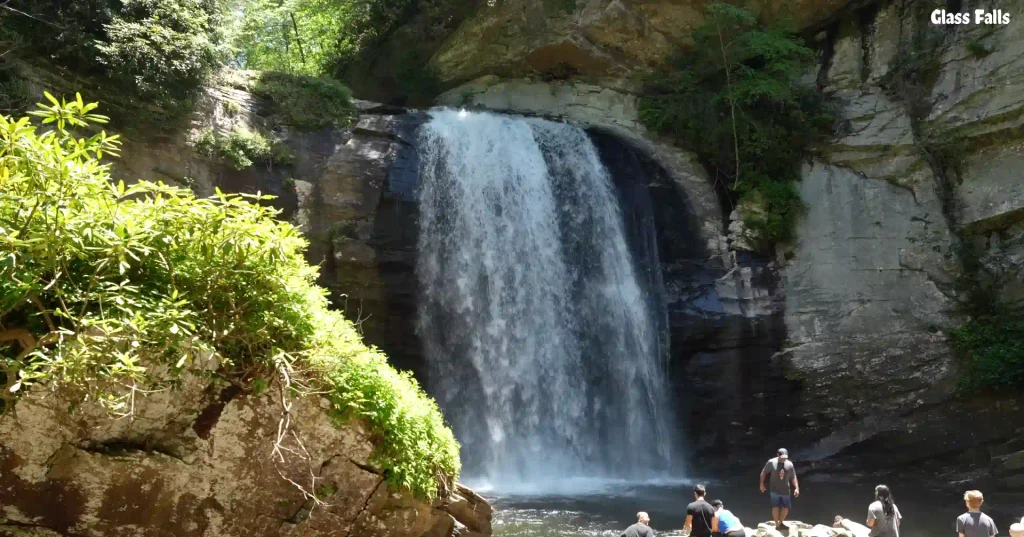
- Looking Glass Falls: Super accessible with a great overlook for folks with mobility challenges. It gets its name because the water looks like a mirror when it freezes in the winter.
- Linville Falls: Dropping 90 feet into what’s known as the “Grand Canyon of the East,” this is one of the most impressive and photographed falls on the route.
- Cascade Falls: Often overlooked but totally worth it. The shady forest trail in E.B. Jeffress State Park leads to a series of stairs revealing a surprisingly massive 90-foot drop.
Iconic Roadway Sights
Sometimes, the road itself is the main attraction.
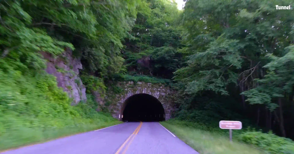
- The Tunnels: There are 26 tunnels along the route (25 in North Carolina and just one in Virginia). The longest is the 1,434-foot Pine Mountain Tunnel. They pop up out of nowhere and are always a thrill to drive through.
- The Overlooks: There are over 200 of them! It’s easy to get overlooked fatigue, so just slow down, see if the view catches your eye, and pull over if it feels special.
- Linn Cove Viaduct: Finished in 1983, this 12,043-foot concrete bridge is an engineering masterpiece. The best view actually requires a short hike to a viewpoint looking down on the curving bridge from above.
- James River Bridge: This is the lowest point on the parkway at just 650 feet. Walk under the roadway on the pedestrian bridge to check out the mid-1800s canal lock trail.
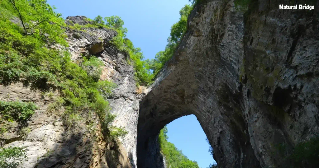
- Natural Bridge: A quick 20-minute detour takes you to a massive 215-foot tall stone bridge. George Washington even carved his initials into the base when he explored it!
History & Mountain Culture
Take a break from the steering wheel to soak in some local heritage.
- Blue Ridge Music Center: You can’t visit this region without learning about bluegrass. Check out the origins of the banjo and stick around for the free live concerts starting at noon. You can even bring an instrument and jam with the locals.
- Cradle of Forestry: Located in Pisgah National Forest, this is the birthplace of modern US forestry. It’s fantastic for families and gives a great introduction to forest protection.
- Historic Sites: Keep an eye out for spots like the Mountain Farm Historic Museum or the Puckett Cabin, home to Orlean Hawks Puckett, a legendary midwife who delivered around a thousand babies.
- Mabry Mill: This is easily one of the most iconic sights on the parkway. The incredibly scenic, century-old grist mill perfectly reflects off the water and often features live demonstrations in the summer.
Blue Ridge Parkway Scenic Drive: How to Enjoy It
The only way to enjoy your scenic drive on the Blue Ridge Parkway is to go slowly. ‘Yes! You read it right. If you go faster here, there is no point in traveling here.
That sounds obvious, but it’s surprisingly easy to forget when you’re trying to reach the next destination. The Parkway’s slower speed and winding mountain road are part of the experience. Leave room for photo stops, wildlife, weather changes and unexpected trail opportunities.
Keep your fuel level comfortable because gas stations are not located continuously along the Parkway. It’s smarter to refuel in nearby towns whenever you’re getting low rather than waiting until the tank is nearly empty.
And don’t rely completely on your phone. The National Park Service specifically warns that GPS systems may not work well for Parkway navigation, which is another reason to understand the milepost system before you leave.
Blue Ridge Parkway NC Trails
If you’re building a road trip around hiking, North Carolina gives you those experiences. The Blue Ridge Parkway NC trails range from short walks to strenuous mountain hikes. That makes it easy to build your itinerary around your fitness level rather than feeling pressured to tackle the longest trail.
Cascades Trail in Blue Ridge
Cascades Trail near Milepost 271.9, for example, is a short moderate loop leading to a waterfall view. The National Park Service also lists lot of trails around Cumberland Knob, Doughton Park, Price Park and other areas.
Asheville Trails
Near Asheville, the Mountains-to-Sea Trail provides another way to explore the surrounding landscape.
The important thing is to check current trail conditions. Storm damage from Hurricane Helene has affected parts of the region, and the NPS warns hikers that hazards may not always be obvious. Don’t choose a trail simply because an old blog post says it’s open. Choose good ones.
Blue Ridge Parkway, Asheville: The ultimate stop
Asheville is arguably one of the best bases for a Blue Ridge Parkway road trip. The city gives you restaurants, hotels, breweries, arts, music and plenty of accommodation choices, while the Parkway begins almost immediately outside the city. By the way, load some snacks.
The Blue Ridge Parkway Visitor Center at Milepost 384 is especially convenient if you’re starting or ending your trip around Asheville. You can pick up information, talk with park staff and learn more about the Parkway before heading into the mountains.
You can also combine a Parkway trip with nearby attractions such as the Biltmore Estate, though I’d recommend giving yourself enough time to explore Asheville itself rather than treating it as nothing more than a hotel stop.
Hotels on the Blue Ridge Parkway, NC
There aren’t hotels sitting beside every stretch of the Parkway, so accommodation requires a little planning. Book hotels before you start.
For the North Carolina section, consider using towns based on your plan. such as
- Asheville, Boone
- Blowing Rock
- Cherokee
- Maggie Valley
- Waynesville
Staying in Asheville works particularly well if you want restaurants and city life at night. Boone and Blowing Rock are convenient for the northern North Carolina mountains, while Cherokee and Maggie Valley work well for the southern end.There are also historic lodges associated with the Parkway, including Peaks of Otter Lodge in Virginia.
If you’re planning a fall trip, book early. Accommodation near popular sections can become expensive and limited when autumn colors are at their best. So, stay cautious when booking.
Blue Ridge Parkway NC Camping Spots and Tips
Camping is one of the best ways to experience the Parkway because it lets you stay close to the landscape rather than driving back to a city every night. So, pack all the needed things like tents, water, gas, lighters, raw food to cook, etc.
The National Park Service currently lists eight developed Parkway campgrounds:
- Otter Creek
- Peaks of Otter
- Rocky Knob
- Doughton Park
- Julian Price
- Linville Falls
- Crabtree Falls
- Mount Pisgah.
There are also three designated backcountry camping areas:
- Rock Castle Gorge
- Basin Cove
- Johns River Road
Campgrounds generally operate seasonally, with the NPS stating that the eight developed campgrounds are open from May through late October, weather permitting.
If you’re camping, don’t assume you can simply pull into any overlook and sleep in your vehicle. If you feel inside of it, it is dangerous at night, and also you feel drowsy to travel the next day. Overnight sleeping at overlooks isn’t permitted. Camping is restricted to designated camping areas.
Pack layers even in summer because temperatures can change quickly at higher elevations.
Blue Ridge Parkway Fall Foliage and When to Visit for Fall Foliage
Many travelers visit Blue Ridge Parkway for a fall foliage experience. The road becomes a ribbon through forests of red, orange, yellow, and gold colors. During this time, the mountain views make the experience even better.
The timing varies by elevation, weather, and location. According to the National Park Service, higher elevations can begin showing color as early as late September, while much of the region develops its strongest colors during October.
If you’re visiting early in the season and the leaves haven’t changed around Asheville yet, you may find better color at higher elevations.
Blue Ridge Parkway Map Closures: Very Important Notice for 2026 Travellers.
This is the section you absolutely should not skip when planning a Blue Ridge Parkway road trip in 2026.
The Parkway has ongoing roadwork and repairs connected to storm damage, bridge rehabilitation and major infrastructure projects. The National Park Service updates road status and closures regularly. Check the updates before you go
This is why an old screenshot of a Blue Ridge Parkway map isn’t enough for a 2026 trip.
Use the official NPS map together with the current road-closure page. The NPS also notes that its LiveMap may not currently display all current closures, so visitors should consult the official Alerts and Conditions information for the latest status. Visit the Blue Ridge Parkway site and get the latest updates for more info.
Blue Ridge Parkway Driving Guide: Tips for a Better Trip
Going slower is the greatest joy you feel while going in a car. Below I mention some practical implications:
Tips to remember:
- Don’t try to drive all 469 miles in one day (takes way too long, speed limit is 45mph, lots of scenic stops). Needs at least 2 days/1 night, or 4 days/3 nights if hiking.
- Best part of the Parkway (author’s opinion): Milepost 291 to 469 (Cherokee, NC to Boone, NC). Very scenic, rides the spine of the Appalachian Highlands, includes Mount Mitchell.
- Alternative shorter route: Cherokee to Asheville, NC. Access to I-26 and I-40 is much easier, close to the Biltmore Estate.
- The Virginia Problem: Roanoke area (Milepost 106 to 135) doesn’t feel like the parkway, traffic is bad, easy to get stuck in the city. Best access in VA is the north entrance at Rockfish Gap (Milepost 0) off I-64.
- Exiting takes time: Getting off the parkway to a town or interstate can take an hour down long, curvy roads.
- Navigation/Apps: Recommends the BlueRidgeParkway.org . GPS/Maps often lie about the closest access points. Cell service is unreliable on the parkway.